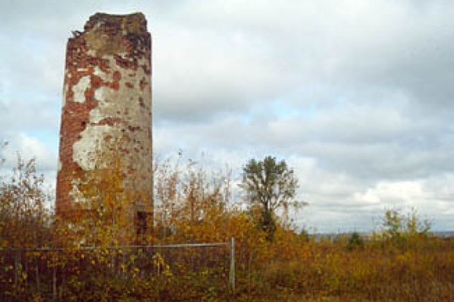
Minnesota Point Lighthouse
Minnesota Point Lighthouse
Duluth
Rapids on the St. Marys River prevented access to Lake Superior from the lower Great Lakes until a set of locks at Sault Ste. Marie were completed in 1855. This new canal bypassed a twenty-one-foot drop in the river and launched the development of harbors and facilities on Lake Superior to exploit the region’s natural resources.
At the western end of Lake Superior, the St. Louis River flows into Superior Bay, a large, natural harbor protected by the world’s longest freshwater sandbar, before emptying into the lake. When work on the bypass canal at Sault Ste. Marie started in the summer of 1853, speculators began buying up land on Superior Bay. The first log cabin was built there in September of 1853, and the City of Superior was officially incorporated a year later.
When the State of Minnesota was created in 1858, the St. Louis River was used as the northern dividing line between Wisconsin and Minnesota, and the City of Duluth sprung up on the Minnesota side of the river to compete with Superior. Reporting on harbor improvements at Superior, a member of the U.S. Army Corps of Engineers stated that the harbor “is to Lake Superior and the country south and west and northwest what the harbor of Chicago is to Lake Michigan and the regions in the same directions.”
The long sandbar protecting Superior Bay is made up of Minnesota Point, which projects eastward for seven miles from Duluth, and Wisconsin Point, which extends three miles from the Wisconsin shore. Realizing the need to mark the entrance to the harbor, known as Superior Entry and defined by these two points, Congress appropriated $15,000 on March 3rd, 1855 for a lighthouse on Minnesota Point. Work on the foundation of the structure started in the fall of 1856, and materials were stockpiled at the point that year in preparation for completing the lighthouse the following season. With the opening of navigation in 1857, work resumed on the lighthouse, but cold weather set in before it could be completed, and the light was not activated until the spring of 1858. Read more by clicking below!
More Information
Content the property of Lighthoue Friends. Photography the property of National Archives and Lighthouse Friends.


